Six peaks of Mount Kinabalu are being remeasured after 28 years
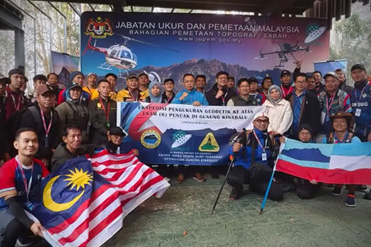
The six main peaks of Mount Kinabalu have become the focus of a geodetic measurement expedition team on a special mission that began on Monday.
This collaborative expedition between Sabah Parks, the Department of Survey and Mapping Malaysia (JUPEM), the Sabah Lands and Surveys Department (JTUS), and the Royal Institution of Surveyors Malaysia (RISM) aims to obtain the latest scientific data on the elevations and geodetic positions of Kinabalu’s peaks after nearly three decades.
The official flag-off ceremony, held at the Timpohon Gate in Kinabalu Park, was officiated by the Director of Survey for the Sabah Topographic Mapping Division, Sr Shaffri Baudi, together with Sabah Parks representative Yassin Miki.
Source : https://sabahmedia.com/2025/08/28/enam-puncak-gunung-kinabalu-diukur-semula-selepas-28-tahun/
Image Credit : Julaimin Kamin